The tribes of Madagascar-the Antandroy
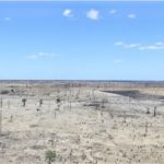
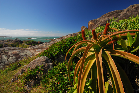
The Androy area stretches between the course of the Menarandra River in the west and the first foothills of the Anosy River in the east. With the exception of the deep Mandraredeveloped since the 1930s through extensive plantations of industrial sisal, the vegetation of the Androy is that of a subarid region.
In the lower Androy (south), which is very dry, the Quaternary marine limestone or dune sandstone remains the 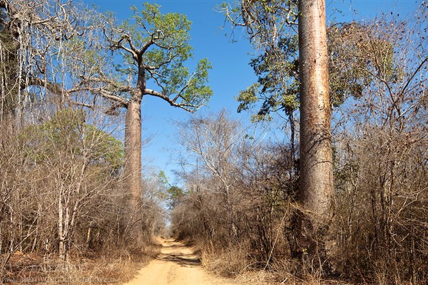 Domain of bush and steppe, while in the upper Androy (north), which is wetter, the crystalline subsoil and the land of volcanic origin favor a wooded savanna.
Paradoxically, the south is more populated than the north, but everything is relative: only a little more than ten inhabitants per square kilometer...
The route of the RN 10, from Beloha to Amboasary, about Tsihombe and Ambovombe (Toponyms denoting the socio-religious primacy of breeding, Omby ("Zebu"), more or less follows the boundary between the two Androys.
Although this southern region experiences drought most of the year, dry season storms (December - April) and Mediterranean showers in July can provide unpleasant surprises for motorists by turning into swamps for several days on certain sections of the national highway.
Androy, the land of thorns
Three shrubs are dear to the Antandroj: the Fantsiholitra (Alluaudia procera), the Roy (Mimosa delicatula), a thorny tree that gave its name to the region and its inhabitants, and the Raketa (Opuntia dillenii) or prickly pear.
Introduced in the 18th century by the Count of Modave in southern Madagascar, the Raketa once covered  wide areas and represented a true gift from God in times of famine. The figs fed the men and the leaves, freed from their thorns by a passage in the fire, gave food to the animals.
By using these fleshy and thorny plants to build virtually inextricable hedges around their villages, the Antandroys were able to resist French colonization until 1905.
But in the 1920s, on the advice of botanist Perrier de la Bathie, the French introduced a pest that destroyed almost all the prickly pear trees within a few months, not without causing a catastrophic famine.
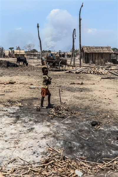
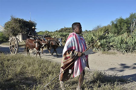
In this country, where zebu and goat farming is associated with a meager food-producing agriculture, the water issue remains crucial.
Rivers are mostly irregular, so that slightly brackish water has to be taken from the holes dug and deepened daily in the sand. At the end of the dry season, people queue up at the edge of the only and last "well", which is laboriously maintained and dug by the whole village. These vovo (water holes) are more than providential ...
To paraphrase Jean Féniès, the former colonial administrator, "drought determines human evaporation." According to a long tradition, when survival is at stake, Antandrovians leave their village to settle in Toliara (Tuléar, which is rickshaw puller for many of them), throughout the west to Antsiranana (Diégo Suarez), see on the highlands. Some of them even emigrated to Reunion Island in the 1920s and 1940s.
Since the 1990s, the European Development Fund (EDF), the Food and Agriculture Organization (FAO), and many non-governmental organizations (NGOs) have engaged in unprecedented but still insufficient activities in Androy to rationalize the management of scarce water resources (drilling wells, irrigation canals, etc.).
Despite their hard existence, the Antandroys, solid workers, vigorously preserve their identity. Endowed with genuine artistic talents, they are known for their musical talent and rhythmic songs.
FROM TRANOROA to TSIHOMBE :
Beloha (61 km south of Tranoroa). The market stalls of this sandy stopover are a reminder of the poverty of this drought-stricken region: only prickly pears are sold here.
Tsihombe (55km south of Beloha). This town, known from afar for its radio relay station, is arranged around a small square surrounded by gargots overlooking the town hall and the market.
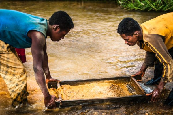
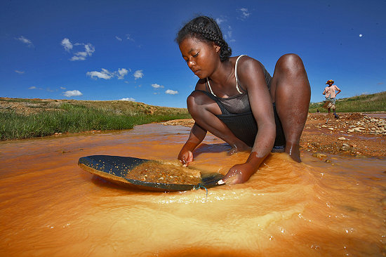 Sapphire Mines. If you inquire at the Tsihombe Municipal Council, it is possible to visit the water sapphire mines. You drive thirty minutes through the bush and follow the path that passes in front of the Protestant temple.
The miners have built their straw huts on a hill, and in the courtyard of each of them women sort out the dense blue stones, studying them in the sunlight.
Betanty (30 km south of Tsihombe, on a well-kept path with graves). Betanty owes its former name "False Cape" to Portuguese cartographers who five centuries ago adopted the location for the southern tip of Madagascar, actually Tanjona Vohimena (Cape Sainte-Marie).
Its long sandy beach and very safe lagoon have made Betanty a pleasant little resort.
You can buy beautiful lobsters from the fishermen, take pirogue rides in the lagoon - watching the passing whales from April to November - and hikes to Tanjona Vohimena (Cape Sainte-Marie) by bivouacking on the beaches.
Tanjona Vohimena (Cape Sainte-Marie) 50 km southwest of Tsihombe, this place beaten by the winds and signaled by a disused lighthouse marks the southern tip of the island. Tanjona Vohimena has been established as a "special reserve".
Ambovombe (67 km east of Tsihombe). Ambovombe is the capital of Androy and an important transportation hub. Ambovombe is a lively town, especially on Monday, market day. Throughout the week, artisans propose hats, rosewood and fine stone objects in front of the Antandroy bush cab station.
Amboasary-Sud (35 km northeast of Ambovombe)
This small town in the lower Mandrare Valley is the center of a sisal-producing region and the outlet for the sapphire mines of the Anosyrian ranges, which have attracted prospectors and lapidaries from Taiwan, Thailand, Europe, and the United States since 1994.
 To the east of the city, a metal bridge built during the colonial period by Gustave Eiffel's company spans the River Mandrare.
This river, whose bed is up to 400 meters wide in places, rolls stormy waves in the rainy season, but in the dry season it is reduced to large masses of water in which the villagers of the area come to wash clothes.
Androy Museum, Berenty Reserve (5 km northwest of Amboasary)
A museum of the Androy, called Arimbelo ("coal of life"), opened in 1995 in this private nature reserve of 265 ha, a true oasis on the course of the Mandradre. Like the reserve, it was created on the initiative of the planter and hotelier Jean de Heaulme.
Four halls present the Antandrojs in their environment, their daily life, especially through their crafts and the great ceremonies that characterize their existence, and trace the history of the region through archaeological research.
The museum also offers a reflection on environment and development.
There you can see an old house rebuilt with scrupulous accuracy, and outside the reconstruction of an old burial ground and a small family enclosure with its houses built and furnished according to tradition.
Arimbelo is the name of the piece of cabbage that a father (or a mother) wets with his saliva or a little water to draw a vertical line on the belly of his child, blessing it by transmitting his life force.
Antanandava and the Anony Lake
Near the village Antanandava (about ten kilometers south of Amboasary) and the mouth of the Mandrare River, a beautiful set of sharp dunes develops whose inexorable progress over the vegetation can be observed.
 From Antanandava you can reach the banks of the Lake Anony (25 km southeast of Amboasary), an extensive saltwater deposit suitable for water sports and separated from the sea by a dense chain of white dunes.
After the Ranopiso Pass the vegetation changes radically, revealing the climatic barrier that separates the arid west from the humid east.
Lamba Antandroy
The weaving of Wild Silk Lamba ("fabric") was continued in some localities in Androy. The red lamba from the Ambondro region is sold in the markets of Amboasary (Sunday), Ambovombe (Monday), Beloha (Tuesday), Tsihombe (Friday) and of course Ambondro (Saturday).
The black lamba of Tranoroa and Bekitro can be bought at the local markets, but also directly from the weavers. In addition, you can buy a beautiful traditional lamba from Ambondro at the Androy Museum in Berenty.
The tomb of Antandroy
The Antandroy tomb is a parallelepiped construction, once of dry stone in the north, rot-proof wooden palisade in the sandy south, now masonry.
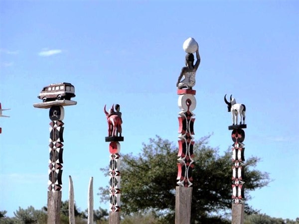 The simplest model measures 5 to 6 meters on each side and is decorated with white geometric patterns. The richest are about 20 square meters and covered with frescoes. A central building houses the coffin. There is also a more sober model, in beautiful ashlar.
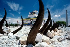
The carved posts (aloalo) that surmount the tombs are a tradition of the land Mahafaly, which was adopted in the region adjacent to Beloha, where you can admire the most imposing burials.
Funerals at the Antandroy
Several months pass between the death and the burial of the deceased. In the meantime, ceremonies are held with Zebu Victim held.
Antandroy ceremonies
In the Androy, clans and lineages are the framework within which each individual finds his identity. A lineage unites all descendants in the paternal line of a single ancestor, often a thousand people.
The great ceremonies - Invocation of the ancestors (soro), preparation ritual for circumcision (savatse), 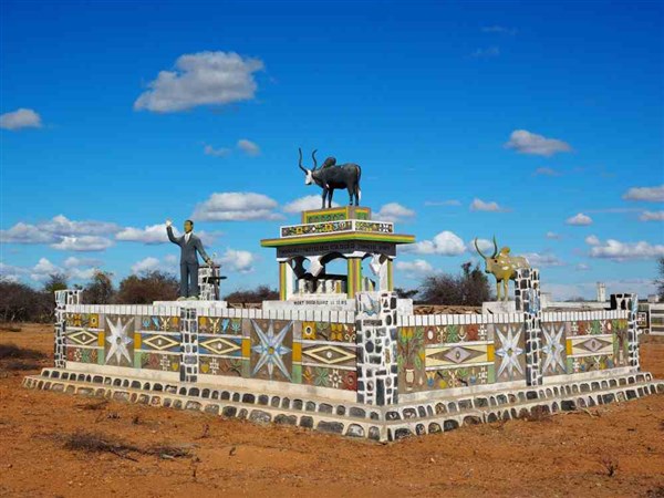 Funerals - are traditionally held at the foot of the hazomanga (sacred pole that materializes in the form of a bundle of sharpened stakes - the bond that unites all living and dead members of the same lineage).
The Hazomanga is under the guard of the mpisoro, the patriarch of the lineage and head of the ritual. The lineages of northern Androy greatly respect their hazomanga and their mpisoro. In the south, however, the mpisoro become rarer, and soro takes place in a family setting under the authority of the father.
Robert Drury
This English sailor, shipwrecked on the coast of the Pays des Epines in 1701, was enslaved by the Antandroy family.
Able to set up solid complications to thwart any traps designed to test his loyalty, Drury forced his way into the retinue of the kings of the south and took part in the battles his masters fought the Mahafaly and the Masikoro.
He escaped several times and even changed sides... In 1716 he returned to England, recounted his adventures and described the customs of the Antandroy and their neighbors in a newspaper that has remained famous (Daniel Defoe would have actually written this work and used the knowledge of the illiterate sailor to write Robinson Crusoe).
Tormented by nostalgia, Drury finally left for the Big Island in 1734, where he engaged in the slave trade.
________________________________________
Bibliography
"1943 is a vintage year not yet forgotten, one of the biggest food deficits in the Androy region. 1943 was also a big year for local commerce, which accumulated whole sacks of the jewels that Tandroy women put up in exchange for a few handfuls of food! Hungry people drag themselves to Manambovo or Fort Dauphin and manage to die at the end of their strength there most often. Fifteen thousand people thus disappear. "
Jean Féniès, " Migration tandroy " Bulletin de Madagascar. n° 138, 1957
"The disarmament of the warriors was not without difficulties: from 1901 to 1903 12,232 rifles were withdrawn, but the Antandrojs knew how to renew their arsenal. The Bekily and Bekitro blacksmiths excelled in the art of making rifles with some old, worn parts.
When the administration confiscated the guns, the warriors turned in weapons that were not in order and carefully hid the others. "
Jean Oberlé, Malagasy Provinces, 1979