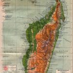
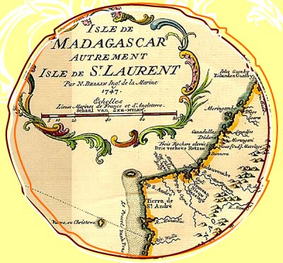
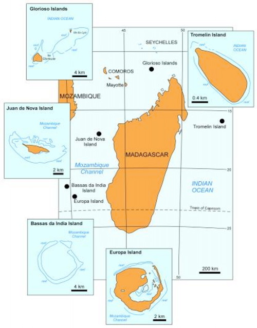
Les Iles éparses and the island of Madagascar
An eventful and exciting history
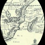
The so-called Les Iles éparses are "scattered islands" off the coast of Madagascar. Originally, these islands were clearly assigned to the country of Madagascar, but since the French colonial rule, Les Iles éparses are French territory. After the declaration of independence of Madagascar, France simply failed to return these islands to their rightful owner, the state of Madagascar. Since then, there have been repeated fierce Discussions, disagreements and arguments about Les Iles éparses. This is not only a matter of clarifying the legal claim to ownership, but also, and above all, of the rights of use for the islands. Currently, various military and meteorological stations are located on most of the scattered islands. In addition, in some areas of the islands, the French government has Nature reserves designated. The Entering is normally only with a special permit possible, although this is generally only granted in special cases. Particularly heated discussions have arisen in recent years, when it turned out that at least on one of the islands, Juan de Nova, rich oil and natural gas deposits are to be recovered. This is understandably another reason for France, not return the islands to the original and rightful owners. Instead, the permission of the two mining companies operating on Juan de Nova on behalf of France was just recently extended. Les Iles éparses, by the way, are not the only example of the shadows of colonization that can still be seen today with regard to France. There are also some islands in Antarctica that are still under the control of the French government. They are controlled by the French prefects for the TAAF (Terres Australes et Antarctiques). The islands are known as French overseas territory and the protests of the locals and the actual owners went almost unheard. Only in October 2015, the French ambassador in Antananarivo publicly declared that Les Iles éparses belong to France.
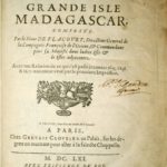
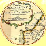
The scattered islands and their history
The strategic advantageswhich France can procure on the basis of Les Iles éparses, in combination with the rich mineral resources will certainly continue to cause all kinds of discord in the future. The greatest fear of the conservationists, on the other hand, is that the currently designated nature conservation zones will sooner or later be abolished in order to recover possible mineral resources. Swallow colonies and especially also rare sea turtles In the following, we will take a closer look at two factors: Which islands are Les Iles éparses about and what is the history of these particular islands?
Bassas de India
Geographical coordinates: 21° 29′ 10″ S 39° 40′ 51″ E
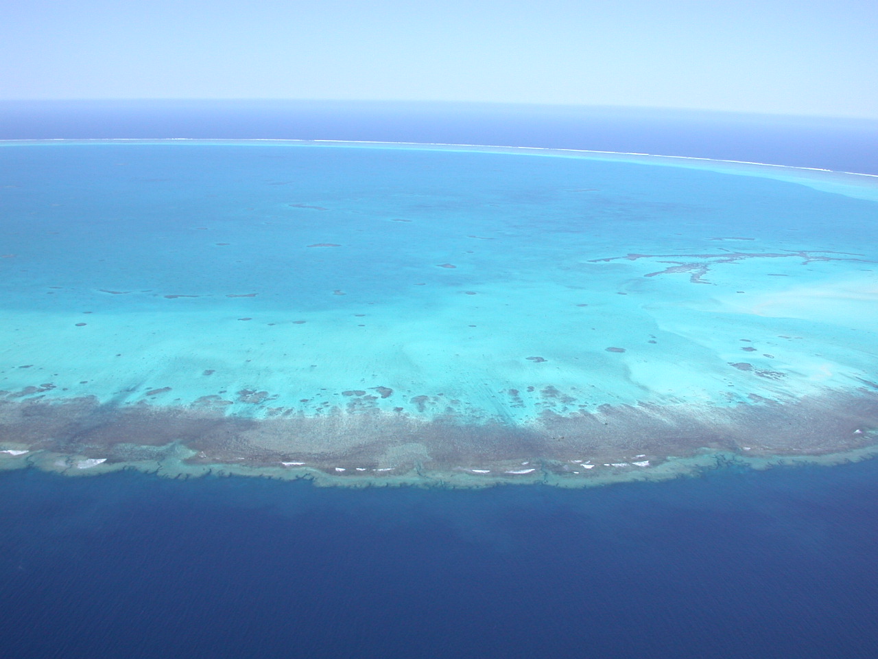
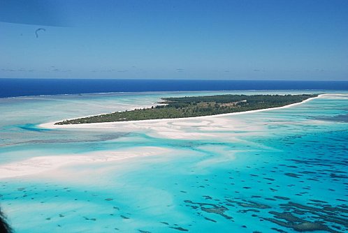
Bassas de India is actually not an island in the literal sense. Rather, it is instead a tiny atoll. This atoll is located south-west of Madagascar in the Mozambique Channel, but for several years it has officially belonged to the French Overseas Territory. Bassa de India was discovered at the beginning of the 16th century by Portuguese sailors. However, the current name of the island comes from a British navigator named Owen. Bassa de India is a uninhabited atoll. Taken together, the many tiny islands have a diameter of about ten kilometers. The total land area of the islands surrounded by stunning coral reefs is only 0.2 square kilometers. At high tide, the islands are sometimes completely submerged, as the highest elevation is just 2.5 meters high. Because of the risk of flooding, not even birds feel at home on this island. However, flooding at high tide brings another consequence: when the island becomes invisible at high tide, it harbors for seafarers a danger that should not be underestimated. Accordingly, some ships have run aground off Bassas de India. Some shipwrecks such as the Santiago, which sank in 1585, have already been extensively studied.
Europe
Geographical coordinates: 22° 22′ S 40° 22′ E22° 22′ S 40° 22′ E
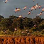
The island with the catchy name Europe also belongs to the French overseas territory and is Managed by the TAAF. It is also located in the Mozambique Channel, at about the level of Tulear and includes a Total area of about 28 square kilometers. On the island there is a meteorological station, which is managed by French, and a military garrison. Twelve people live on the island. Access is granted to visitors only with a special permit,Apart from this, the coastline, which is about twenty kilometers long, is in large parts tendered as a nature reserve been. Especially Birds and sea turtles feel safe there. The island does not have its own harbor, so a landing strip has been built.
Glorieuses
Geographical coordinates: 11° 33′ 20″ S 47° 20′ 33″ E
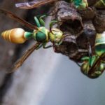
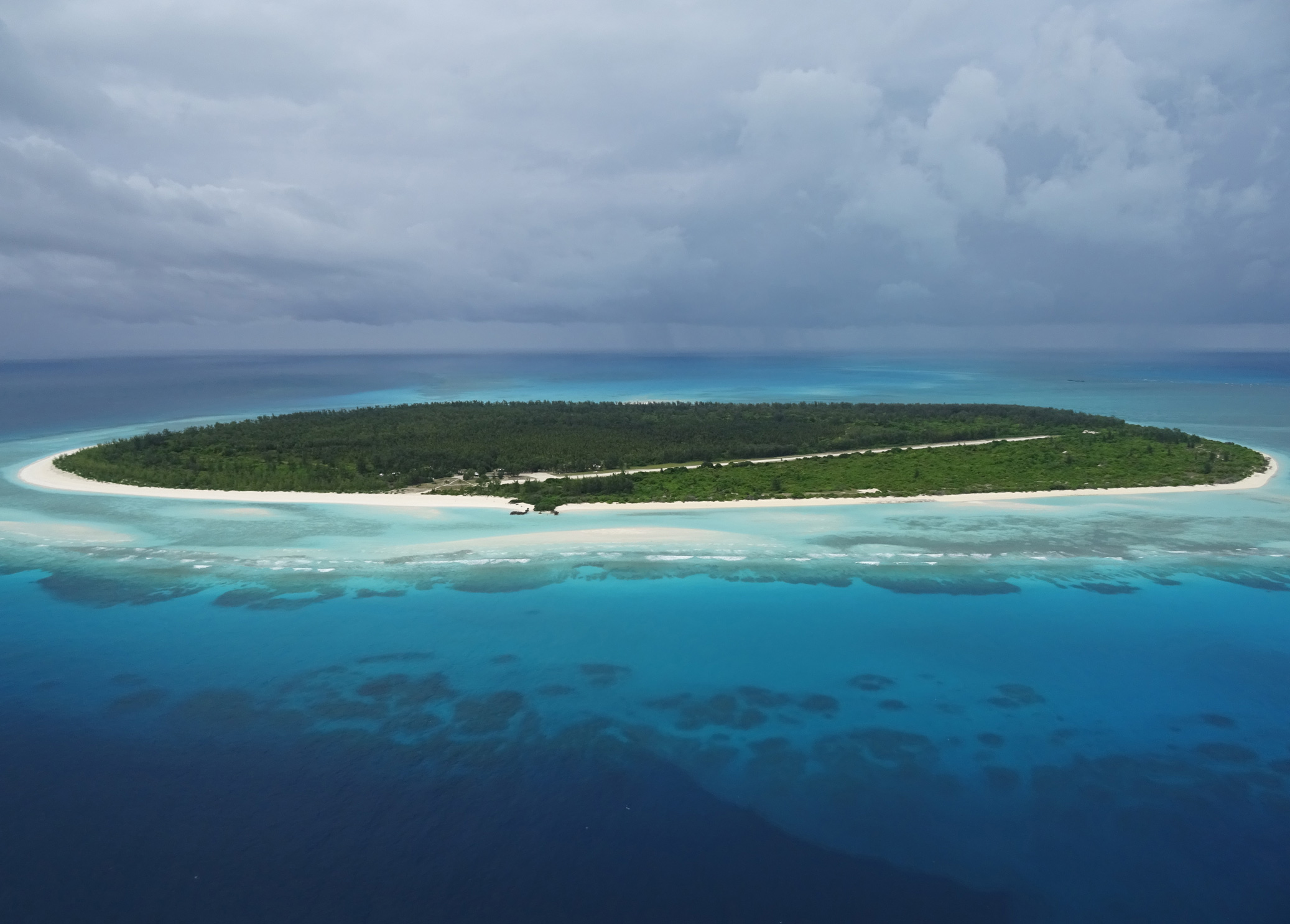
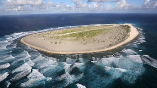
The so-called Iles Glorieuses, in German: Die Glorious islands, are located in the northwest of Madagascar. It is a group of several tropical islands, which since the end of the 19th century have been in French possession are located. Before the Second World War, the islands were home to the Production of corn and coconut in focus, but after the war the plantations were shut down. Instead, since the 1950s there has been one of France's meteorological research stations on the island. Today the islands as well as the surrounding marine zone are a contiguous nature reserve, the management of which is assigned to the French prefects of the TAAF subject. While on the main island L'île Glorieuse mainly a wild forest can be found, which are remnants of the former coconut plantations, the smaller island with the name Ile du Lys is rather rocky and sandy. Smaller rocky islands also belong to the atoll. The Iles Glorieuses are shallow islands that are surrounded by breathtakingly beautiful coral reefs are surrounded. Many birds, such as terns, are native to the islands and the rare sea turtles use the island to lay their eggs in the fine sand. In addition to the meteorological research station, the island is also home to a Base of the French Foreign Legion. The island can be reached either by plane or by boat, but this requires a special permit.
Juan de Nova
Geographical coordinates: 17° 03′ 16″ S 42° 43′ 30″ E
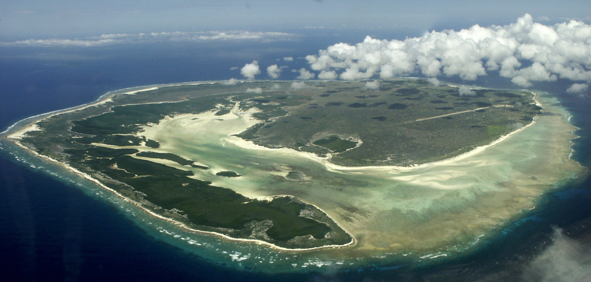
The island Juan de Nova is now one of the most important and hotly contested islands off the coast of Madagascar. The island is located between Madagascar and Mozambique and has a length of about six kilometers and a width of about one and a half kilometers. The island was originally uninhabited, but there are now some people there. These occupy a military station as well as a meteorological system. In addition, there are now also the various workers who work with the Drilling for crude oil as well as the production of natural gas are busy. The island of Juan de Nova was discovered by a Spanish admiral named Juan de Nova. Partly it is surrounded by a beautiful coral reef surrounded, but access is relatively uncomplicated. A good half of the island is covered with dense forest. Various Tern colonies can be found here. In addition, there are several other species of birds on the island, but most likely they have been introduced. Besides the birds, the most important for the island are the Sea turtles of great importance, which use the fine sand of the island beaches to lay their eggs. Precisely because of the various holes is the natural paradise on the island in great danger.
Tromelin
Geographical coordinates: 15° 53′ 31″ S 54° 31′ 23″ E
Tromelin is an island located in the Indian Ozrean, positioned northeast of Madagascar. The relatively small island was discovered for the first time at the beginning of the 18th century and at that time initially Ile des Sables called. This name arose due to the flatness of the island and the fact that it had almost no vegetation cover. The island of Tromelin is characterized by its extraordinary and fascinating story, which has kept researchers enormously busy for years. Various excavations have already aimed to explore the mystery of the island, but so far the scientists have not yet reached the end of their research. The adventurous story of the island began in the 18th century, when the slave ship L'Utile on the island of Tromlein, which was not yet marked on maps at that time Shipwrecked, that happened on 31 July 1761. At that time, the ship had departed from the east coast of Madagascar and had around 180 Malagasy slaves on board. About 70 of these slaves and 19 sailors died in the first time after the shipwreck before they could reach the island, 210 people survived. The stranded people first had to dig an entrance to a water source whose water was almost undrinkable anyway, and they could feed on only one source of food: The eggs of the frigate colonies breeding on the island. Little by little the slaves had to assemble a raft from salvaged wreckage partsAfter production, however, it was only used by the French to sail back to Madagascar. The surviving Malagasy were left to their fate. Some of the French tried to set up a rescue mission after their return to save the slaves as well, but were prevented from doing so by the governor. The people of Tromelin were accordingly abandoned to their fate and faced with very low chances of survival confronted: The island was so flat that it would inevitably be flooded in a cyclone, and the food consisted only of turtles, seabirds, fish and the eggs of birds.
Many years went by and the people on Tromelin defied their terrible fate. Once a French ship approached the island, but the crew did not consider it necessary to rescue the people on the island. Only after a few more years came again a french ship in sight and dispatched a sloop with two Frenchmen on board to the island. While crossing the reef, however, the sloop sank - one of the two Frenchmen saved himself back on the ship, the other reached the island with difficulty and hardship. Now that there was a Frenchman on the island worth rescuing, some time later the French sent the La Dauphine to the small island, which was now called Tromelin. When the ship reached the island, there were only 8 people left to be encountered, seven women and an eight-month-old babywhich turned out to be the son of the Frenchman who made it to the island after the sloop sank. Until today it is not clear how people managed to survive on the island of Tromelin. Today it is clear that the people on the island dhe fire never went out for 15 yearssince it would not have been possible for them to light a new one. They made their Clothing from bird feathers on and survived in a coral grotto, in which they were at least partially protected from the weather. In the 1950s, the French built a Weather station on Tromelin built. There they found the coral grotto exactly as the women had left it some 200 years ago. In the meantime, on the island around 20 meteorologists stationed. Archaeologists are also trying to understand the survival of the stranded people through various researches